We're recently back from an amazing trip to Yukon, the North West Territories, and Alaska!
We rented a Jeep with a roof top tent in Whitehorse from Overland Yukon and spent two weeks driving the Dempster Highway, up to Tuktoyaktuk on the Arctic Ocean, followed by a quick diversion into Alaska along the Top of the World Highway.
This was our first visit to NWT and Alaska, but our second trip to the Yukon, after visiting in March 2022. It was great to see the contrasts between Summer and Winter. You can read more about our Winter visit, which focuses on Whitehorse and Dawson City.
Day 1 - Whitehorse
We were met at Whitehorse Airport by Andrew from Overland Yukon, who introduced us to the vehicle that would be home for the next couple of weeks and showed us how to set up the roof top tent. The roof tent is really simple and quick to set up, and we were very impressed with how comfortable it was. With our family of four, we opted to upgrade for the larger tent, and it fit us perfectly.
We then drove into Whitehorse to pick up some supplies, including the all important beer and gin from Yukon Brewing! With an afternoon arrival and knowing that we needed to stock up before heading on the road, we decided to spend the night near Whitehorse, so opted for a night at Caribou RV park. It's a great full service campground on the southern outskirts of Whitehorse, where we stayed in a cabin at the end of our Winter trip.
The first set-up of the tent on our own went very smoothly thanks to Andrew's clear instructions, and we were quickly ready to enjoy a beer and the free popcorn (Fridays only) on the deck outside the campground reception, before heading next door to the Wolf's Den restaurant for dinner.
At this time of year in Whitehorse the sun hardly sets at all, so it was strange going to bed in almost full daylight. A red fox wandered right past the tent just as we were heading up to the tent, which turned out to be the first of many foxes on this trip.
Day 2 - The Klondike Highway
We headed into Whitehorse in the morning and went to the Visitors' Centre to pick up some maps and information booklets. Being Canada Day, there were lots of events planned in Whitehorse, we wanted to hit the road, so didn't get to experience much, but we did go to the pancake breakfast at Shipyards Park. The sourdough pancakes were delicious, even in the rain; as the locals said 'if our beer is worth freezing for, our pancakes are worth getting wet for'!
The 530km Klondike Highway from Whitehorse to Dawson City is paved and can be travelled relatively quickly, (roughly 6 hours) although there was a pretty long stretch of muddy construction work where it wasn't clear which part of the 'road' we were meant to be on! We'd been this route before, so didn't hang around, but there are some worthwhile stops at the Braeburn Lodge (for their famous cinnamon buns) and the Five Fingers Rapids viewpoint.
Fuel stations are few and far between, so take advantage where you can to fill up. We stopped in Carmacks to top up the tank.
Our second night was spent at the Klondike River Campground, just outside of Dawson City. This was to be the first of many Territorial Campgrounds which all have similar facilities; fire rings, free fire wood, pit toilets and picnic tables. The campgrounds cost $20 per night, and work on a self-registration system - take cash and a pen!
Day 3 - The Dempster Highway
The next morning we topped up the tank again and picked up more ice for the cooler in Dawson, before starting on the Dempster. There is also a public card lock gas station at the Dempster Highway junction, so you don't need to go into Dawson City if you don't want to.
The Dempster Highway is 740km of unpaved road between Dawson City, Yukon, and Inuvik, NWT. The road is hard-packed gravel, and traverses some beautiful scenery; varying from huge mountains, glacial valleys, and upland tundra. The route crosses the Arctic Circle, and the mighty Peel and Mackenzie Rivers (by free ferry).
We had a relatively short day today, travelling the first 193km of the Dempster to Engineer Creek Campground (Yukon Territorial). We had a pretty leisurely start to the day, and were just getting used to driving the jeep on the gravel roads, so it probably took us about 3 hours from Dawson City to Engineer Creek including a quick picnic stop at Two Moose Lake.
The Engineer Creek campground is right by the Ogilvie River and is a great site, although the biting bugs were some of the worst we were to come across on the whole trip. We highly recommend taking a Thermacell repellent (you will need to buy the gas refills on arrival in Whitehorse if you are flying in)!
Day 4 - Crossing the Arctic Circle
Now getting used to the road, and after a short previous day, we were ready to tackle a good stretch of the Dempster by Monday.
After a quick stop in Eagle Plains for gas and lunch in the roadhouse restaurant, we continued north to the cross the Arctic Circle at 66°33' N and onwards over the Yukon / North West Territories border.
Just south of Fort McPherson we took the free ferry over the Peel River, and then stopped at the NWT Territorial Campground at Nitainlaii (about 345km from Engineer Creek). With the stop for lunch, this was about a 6 hour day.
Despite some serious swarms of flies around the Jeep as we waited for the ferry and on arrival at the campground, the bugs really weren't too bad! We were the first to arrive at the campground so found a shady spot with a bit of a breeze which really helped, not that it really got full at all. We were really surprised by how warm it was north of the Arctic Circle, with temperatures hitting almost 30 degrees C tonight, and remaining in the high 20s for most of our trip! By now we had 22 hours of full sunlight per day, so it never really got cold at night either.
This campground also had hot showers and flushing toilets, luxury!
Day 5 - The Road to The Arctic Ocean
The next day we completed the last 190km or so of the Dempster and made it to Inuvik, Canada's largest settlement north of the Arctic Circle. After a trip to the visitors centre, we filled up at the gas station, and resupplied at the grocery and liquor stores.
The short stretch of paved highway between Inuvik airport and the town was a welcome relief but didn't last long, as it was soon time to hit the Inuvik to Tuktoyaktuk Highway. The first road in North America to reach the Arctic Ocean; the ITH, or Road to the Arctic Ocean, was completed in 2017 and linked Canada from Coast to Coast to Arctic Coast by road for the first time. The gravel highway stretches 140km from Inuvik to Tuk. Crossing the Arctic treeline just north of Inuvik you leave the Boreal Forest and enter the wide open tundra of the Barrenlands; home to herds of reindeer and caribou (although we saw neither!).
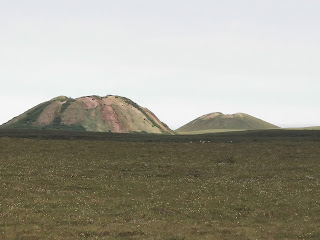
While the ITH is well maintained and doesn't have many potholes, it is very thick gravel which hasn't been as compacted as some of the previous sections of road; we found it pretty slow going. The 345km or so from Nitainlaii to Tuk took us about 6 hours including the stops in Inuvik. Just south of Tuk, you'll see the Ibyuk Pingo rising up from the surrounding flat tundra. Pingos are unusual hills formed around a core of ice, and there are 1350 of them in the region. Ibyuk is Canada's tallest and the world's second-tallest pingo at 49 metres (about 161 feet) in height. Eight of these pingos are protected by Parks Canada as the Pingo Canadian Landmark.
On arrival in Tuk, follow the road through the hamlet to a spit of land jutting out into the Arctic Ocean, here you'll find the famous sign and also the informal camping spots backing onto the ocean. We'd heard that there was a fee for camping, but we didn't find any details of how to pay and no-one came around! There are a few picnic benches and some 'porta-loo' style toilets for campers.
Day 6 - Tukoyaktuk
Tuk has more of interest than it appears at first glance, check out the beautiful carving highlighting important people in Tuk's history and the sod houses.
Also a dip in the Arctic is a must - our youngest son seems to think putting his finger in counts but we aren't so sure! Chat to the locals, it is super interesting to hear what they are doing, and understand more about their way of life. We also managed to buy some "Eskimo donuts" from a lady who drove by the campground and was selling them fresh, and they have to be one of the most delicious things we have ever tasted, with 6 holes rather than our one!
Day 7 - The Road to the Arctic Ocean (Southbound)
After a couple of beautiful nights camping by the Arctic Ocean, we were sad to leave Tuk. We headed back down the ITH, stopping again in Inuvik for gas, ice and groceries. Then we were back on the Dempster heading south.We spent the night at the Gwich'in Territorial Park campground, which had great views over Campbell Lake, and was pretty much deserted on a Thursday night. With the stop in Inuvik, it took us around 3 and a half hours to cover the 190km.
Day 8 - The Dempster Highway to Eagle Plains
We really wanted to camp at Tombstone Territorial Park, on our way south, so it made sense to break up the journey at Eagle Plains. While it looks like a major settlement on the maps, Eagle Plains is really just a roadhouse. The facility was purpose built at the halfway point between Dawson City and Inuvik and consists of a gas station, motel, tire repair shop (of course), restaurant, (of sorts, it had a canteen like feel to it, but isn't bad and certainly serves a purpose out there), bar (complete with a ton of stuffed animals and a pool table) and campground.
It's not the most scenic campground, and feels a bit like a car park, but the views are amazing and we managed to find a small back-in site amongst the trees at the edge of the site. There are decent washrooms, and a pretty run down shower facility, but the bar was open serving cold beer, and the boys enjoyed a couple of games of pool, there is also decent wifi service. It really filled up as the afternoon went on, so I'd recommend getting there fairly early in the afternoon if you can. The 330km from Gwich'in took us around 5 hours.
While we had been lucky so far with respect to punctures, we met one traveller who had been stuck at Eagle Plains for a week while waiting for replacement tires to come in. She was in a small VW car, which probably had an unusual tire size, and only had a 'donut' spare, so her experience is probably not the normal, but it really reinforced the need for a full size spare (or two if you can) as well as the tools and ability to change a wheel!
Day 9 - The Dempster Highway to Tombstone Territorial Park
After a hearty breakfast at Eagle Plains we continued down the Dempster to Tombstone Territorial Park. After feeling pretty smug yesterday about managing to avoid a flat, and getting a bit complacent about state of the roads, we hit a series of potholes just north of Tombstone and picked up a massive puncture in the sidewall of the tire.
We quickly changed the wheel for the spare, but certainly travelled the last section to Tombstone a lot more carefully knowing we didn't have another spare, and would need to make it Dawson before we could pick up a replacement.
The campground at Tombstone is beautiful, and after a leisurely breakfast and the puncture it was about 1700 before we arrived. Being Saturday night, the campground was pretty full, but we still managed to find a great spot.
Day 10 - The Dempster Highway to Dawson City
We had hoped to do a bit of exploring around Tombstone Park, but with the flat we decided to make an early start and head down to Dawson with the hope of sorting a replacement tire. We took the 110km pretty slowly, so it probably took us a couple of hours. Unfortunately as it was Sunday, none of the tire shops we found were open, so we had some delicious coffee and breakfast at the
Riverwest Bistro, before checking into the
Downtown Hotel, which has been taken over by Coast Hotels since we stayed last year.
Knowing we were stuck in Dawson for a while at least, we decided to take advantage of the hotel for proper showers and a chance to do some laundry. We spent the rest of the day exploring Dawson in the summer.
Since Coast took over, the Sourdough Saloon has been opened up to children, so we also got the chance to partake of a Sourtoe Cocktail that we missed out on last time. The Sourtoe cocktail traditionally involves Yukon Jack whiskey and a severed human toe! The story goes something like this:
Apparently two bootlegging brothers got caught in a snowstorm, one had fallen through the ice and got a wet foot. He got frostbite, and his brother chopped his toe off with an axe. They decided to keep the toe in a jar of whiskey, and left it in a cabin. Years later someone found the jar and decided to drink the whiskey, I think it was probably a drunken bet! And so the sourtoe cocktail was invented. Or something like that anyway...

Day 11 - Dawson City
On Monday morning I took a drive back to the nearest tire store, to see about a replacement. They didn't have our size in stock, but ordered one from Whitehorse which would come in the following morning. That gave us another day to further explore Dawson. We took a trip up to the Midnight Dome to compare the Summer and Winter views over the city, had lunch at
Sourdough Joe's, and visited the Dawson City Museum. The museum tells the story of Dawson City through the Klondike Gold Rush era and is well worth a visit.
One night in a hotel was enough for us (or Ridley anyway!), so we decided to take the (free) ferry over the river and camped at the Yukon River Territorial Campground in West Dawson. Last time we were here we drove over the river on an ice bridge, so this was a pretty cool comparison!
Take a wander through the campground and a little further down the river you'll find the Paddlewheel Graveyard, where you can explore the remains of three abandoned paddlewheelers left high and dry on the shore. This was a favourite part of the trip for the boys who really enjoyed figuring out which bits of the old steamers they were climbing on.
Day 12 - The Top of the World Highway
The next morning we swung back over to Dawson to pick up the new spare, (they had said they would let us know when it was ready but we called early and it had been done so best to check in if you want to get going), and then crossed the river again to head west on the Top of the World Highway.
The Top of the World is another (mostly) unpaved road between West Dawson, Yukon, and Jack Wade, Alaska where it joins the Taylor Highway (which continues on to Tok). So called because it travels most of its 127km length along the ridge of a mountain with expansive views over the valleys on both sides, it really does feel like you are on the top of the world. Don't be lulled into a false sense of security when you cross the border at the Poker Creek crossing; although the first 10kms on the US side are beautifully paved, it soon reverts to rough gravel!
The first settlement you come across is Chicken, Alaska. This small gold mining hamlet, was originally intended to be named Ptarmigan because of the number of the birds in the area, but none of the miners could spell it so they settled on Chicken!
We pulled into the Chicken Gold Camp to check out the giant chicken statue, and the boys spotted that it was pizza night and that they had gold panning. Despite intending to travel a bit further today, the pizza and gold sold it to us, so we decided to spend the night.
We had a great evening chatting to the locals and eating delicious pizza, before wandering up to the Chicken Saloon. The saloon doesn't take kids but is definitely an experience. Ask them the story about the knickers hanging from the ceiling, and if you're lucky you might get to see a pair being fired into the air from a cannon!
Day 13 - Alaska to Haines Junction
After a short day on Tuesday, we knew we had a long day ahead of us to get back across the border and close enough to Whitehorse for our flight the next day. The map said that the Taylor Highway to Tok (pronounced toke) was paved, which the majority of it was, but there were some really rough sections and it was pretty unpredictable, watch out for the orange cones (pylons) by the side of the road which mark some of the worst potholes. There were some long sections of road construction works, with pilot trucks leading the traffic through, and the border crossing at Beaver Creek was pretty slow.
We had planned to camp at Congdon Creek on Kluane Lake, which looked like a great spot, but due to the presence of lots of bears in the area all tents had to camp within a bear proof electric fenced area. Unfortunately this area wasn't accessible to vehicles, it stated solid sided campers in the other areas and we didn't feel comfortable risking being in the roof tent outside of the fence, so we had to carry on towards Haines Junction and eventually camped at the Pine Lake Campground. This was a journey of over 550km, and took us over 8 hours of driving. In hindsight this was a very long day, and we should have left longer for this section of the journey, but we were constrained by the unscheduled stop in Dawson City and our flights the next day.

The weather was pretty awful for most of the afternoon, which meant we missed out on what should have been beautiful views of Kluane Territorial Park and Canada's tallest mountain - Mount Logan. The rain continued all evening, so we hid in the tent and played cards!
Day 14 - Haines Junction to Whitehorse
After a very quick pack up in the rain (we were getting pretty good at packing up the tent by now anyway), we headed down the road to Whitehorse. The weather cleared as we got closer to Whitehorse, and we headed back to Shipyards Park (where we had the pancake breakfast on Day 2) to re-organise our kit and clear out the Jeep while the boys played in the great playground.
After a quick lunch, we headed to the airport to meet Andrew and hand the vehicle back, before catching our flight. We were all very sad to be leaving the Yukon, but we were heading to Calgary for Stampede, so that made it more exciting!
Top 10 Tips for the Dempster Highway
1. Leave plenty of time, the highway is unpredictable! We were lucky and only had a couple of days of unscheduled stop in Dawson, but some people spent much longer waiting for tires.
2. Take a full size spare (or two if you can), and make sure you have the tools and know how to change a wheel.
3. Make an effort to get to your 'must see' spots early in the journey, so you have time for un-expected challenges.
4. Go at your own speed on the highways, you will get other vehicles travelling faster (and slower) than you, but just pull over and let them pass.
5. Fill up on gas, water, ice, food and booze whenever you can. It's a long way between some places to stock up and if you end up somewhere without a store at least you are prepared.
6. Speak to the locals, they are full of interesting stories and helpful information.
7. Keep the bug spray handy in the glove box, and make it the first thing you do on arrival at the campground. But also don't be put off by the bugs, sure some places were pretty bad, but most weren't!
8. Pick up a campground map at the visitor centres in Whitehorse, Dawson and/or Inuvik. There are plenty of campgrounds, but some are more spread out than others.
9. Try not to overplan! This was a challenge for us, but all of the campgrounds are First Come First Serve anyway, so just go with the flow.
10. Pack a solar shower, the vast majority of campgrounds don't have showers and a solar shower is handy for a quick freshen up.


